Lab 1: Creation of a Digital Elevation Surface using Critical Thinking Skills and Improvised Survey Techniques
Lab 1: Creation of a Digital Elevation Surface using Critical Thinking Skills and Improvised Survey Techniques
Introduction
The process of sampling
is a simplification process that allows one to describe a whole population or
area. One takes a sample of data from just a portion of the population or area
and then applies those data points to the whole population or area.
Major Sampling Techniques:
• Random: This method takes data in a random fashion with no designated order. This technique works well within the surveying of a human population.
• Regular: This technique provides a designated order for collecting data points. Regular sampling technique works well within a survey of a geographic area.
The objective of this
lab was to help students utilize their critical thinking skills to develop an
efficient way to survey an area. The survey area was a sandbox with the
dimensions 114 cm x 114 cm. Students were divided into groups and directed to make
a terrain of their choice in the sandbox. This group (group 4) completed the
field exercise on Saturday, February 3rd, 2018 between 10:00 am and
1:15 pm.
Methods
This group chose to use a regular sampling technique
for the surveying of the sandbox. Using this method ensured data would be
evenly distributed across the survey area. In order to enact a regular sampling
technique string and tacks were used to make a grid across the sandbox. This
allowed for an accurate and efficient way to survey the terrain. A random
sampling technique was discussed but quickly dismissed for this project because
a regular sampling technique was deemed more efficient.
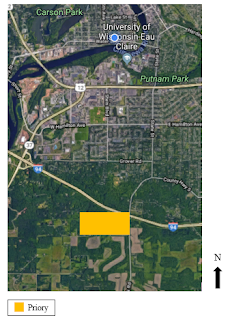
The sandbox used for this lab was on the University of
Wisconsin – Eau Claire campus. It was located approximately 50 meters to the
east of the science building, Phillips Hall. Sandbox number 4 or the sandbox the furthest to the east was used to complete this exercise.
The materials used for this lab included:
•
Sandbox
•
Sand
•
Meter Stick
•
String
•
Tacks
•
Hammer
•
Pencil
•
Paper
•
Computer
• Smart Phone
A terrain needed to be
created before a sampling scheme was set up. Group 4 decided to form a U-shaped
ridge along the north side of the sandbox with two prominent hills in the south
side to create a smiley face (Figure 1). The sampling area was 114
cm x 114 cm. This group set up a grid with 6 cm x 6 cm squares. This was
achieved by placing tacks 6 cm apart along the perimeter of the sandbox and
then using string to make a grid (Figure 2 and Figure 3).
 |
| Figure 1. The terrain created by group 4. The ridge on the bottom creating a mouth and two hills on the top creating eyes. This task was a little difficult as the cold temperature froze a lot of the sand together. |
 |
| Figure 2. Group 4 in the process of creating 6 cm x 6 cm boxes around the sandbox. |
 |
| Figure 3. The finished grid of 6 cm x 6 cm squares within the sandbox. The origin that was designated for data collection is located in the bottom, left corner of this image. |
A sea level needed to be
established for the sandbox in order to obtain accurate z values for our
survey. Group 4 decided that sea level would be the height of the string grid. Meaning
that all terrain below the string grid would be below sea level, or a negative
z value.
Data was then collected with
a meter stick at any point where two strings met and where a string met the
wooden edge of the sandbox. It was determined the lower left corner
(north-east) would be the origin or (0,0). Due to the high volume of points
that were going to be collected, it was decided that the data would be entered
right into the excel app on a group members phone (Figure 4). A phone was used instead of
a laptop due to the weather. A phone is much easier to hold and handle in
snowy conditions.
 |
| Figure 4. This image is the excel app that was used to collect data in the field. |
Results/Discussion
Exactly 400 sample
points were recorded during this survey project. The sample z values ranged
from -19.5 to -6 millimeters below sea level. The mean of the data points was
-14.844 mm, while the median was -15 mm. The standard deviation of this data
set is 2.217. All of the data points taken for elevation were negative, meaning
that none of the terrain created went above the string grid or sea level.
The use of a regular
sampling method worked well for the surveying of the sandbox. Group 4 started
off with one person holding the meter stick and reading off the z values and
another person recording the data into excel. Shortly into the data collection
process (3-4 data points in) the group switch into having one person holding
the meter stick in the correct location on the grid, another reading off the z
value from the meter stick and the final person recording the data onto excel.
This was found to be most efficient. This change in collection method may have affect the first few data points since a different person was reading the
measurements but only slightly and not any major error was created. The largest
issue that was encountered for this group during sampling was the weather. The
cold temperature causes a lot of the sand to be frozen together, which made
creating a new terrain difficult, but using some persuasion a smiley face was
able to be created. It was snowing the entire collection
period; therefore, the sand became covered with snow during the collection time
(see Figure 3). This group faced this problem by just entering the meter stick into
the snow until sand was hit; therefore, attempting to get the elevation of just
the sand and not the snow as well. The snow and cold temperatures also make it
hard to be type in the data points as quickly as they could be read; therefore,
the data recorder needed good communication with the data collectors to ensure
all the data was entered properly.
Conclusion
This method is classified as a regular sampling technique because the data points were collected in a grid fashion; therefore, a regular pattern. The use of sampling in a spatial situation is very helpful to gain an accurate estimate of the terrain in an area without sampling every single section of the area. Collecting data from every point in a survey area is not possible, so sampling is very necessary. This applies to an area that is larger than a 114 cm x 114 cm box, a survey area of 1 square mile will need a sampling method applied to it as well. Just looking at the raw numbers, the data collected looks like it will accurately represent the terrain design. For future surveys, a larger scale could be used in terms of the grid. This terrain had a lot of flat region and therefore not as many data points were needed. If given a flat terrain in the future with few hills and ridges, it would be better to have a higher density of points near these points of relief and less dense on areas of little to no relief. Overall, this group had an efficient and accurate collection process for this sandbox survey.
This method is classified as a regular sampling technique because the data points were collected in a grid fashion; therefore, a regular pattern. The use of sampling in a spatial situation is very helpful to gain an accurate estimate of the terrain in an area without sampling every single section of the area. Collecting data from every point in a survey area is not possible, so sampling is very necessary. This applies to an area that is larger than a 114 cm x 114 cm box, a survey area of 1 square mile will need a sampling method applied to it as well. Just looking at the raw numbers, the data collected looks like it will accurately represent the terrain design. For future surveys, a larger scale could be used in terms of the grid. This terrain had a lot of flat region and therefore not as many data points were needed. If given a flat terrain in the future with few hills and ridges, it would be better to have a higher density of points near these points of relief and less dense on areas of little to no relief. Overall, this group had an efficient and accurate collection process for this sandbox survey.


Comments
Post a Comment